Type of activity
Bioenergy
Liquid natural gas (LNG)
Oil & Gas
Economic diversification
Education
Community health

We operate in Mozambique in the exploration, development and production of hydrocarbons and natural gas, as well as in the refining and chemicals sectors. With the Coral South gas extraction project, launched just five years after its approval, Mozambique is now a leadeing player in the global liquefied natural gas (LNG) market. The benefits are multiple: job growth, greater stability for energy supplies for the domestic market and towards Europe, and diversification of supply sources. We are also developing the Rovuma LNG (Liquefied Natural Gas) gas production and liquefaction and the Coral North projects, which will help consolidate the role of Mozambique as an energy producer. The local production of vegetable oil allows the country to be an active part of our strategy to develop bioenergy for increasingly sustainable mobility and contributes to the expansion of Eni's biorefining activities through the production of agro-feedstock.
Activity start date: 2006 - present
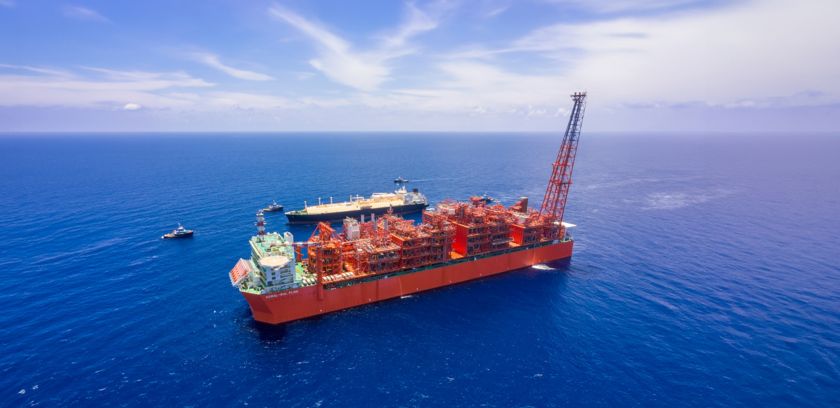
The Coral South project is operational thanks to the discovery of vast gas resources in the Coral, Mamba and Agulha fields located in the deep waters of Area 4 of the Rovuma Basin. The project, which places the country on the international stage of LNG production and export, was launched in line with the envisaged schedule and costs thanks to effective planning, the support of partners and the Mozambique government. The technological core of the project is the Coral Sul FLNG (Floating Liquid Natural Gas) plant, a ship built according to the most stringent energy efficiency standards, through which the gas is liquefied and exported. In parallel, the Rovuma LNG (Liquefied Natural Gas) project is currently under development is for the production, liquefaction and commercialization of natural gas from three fields in the Mamba complex, also situated in Area 4 and which we consider the new frontier in the global oil and gas industry. The Coral North project, also in Area 4, will, once in production, make the country the third-largest LNG producer in Africa and help meet growing LNG demand from Europe and Asia. The area is also used for the cultivation of oilseeds by local agro-industrial companies and for the production of vegetable oil, which will be used as a raw material in Eni's biorefineries.
We promote local development and accelerate the country’s energy transition. We support the protection of people and biodiversity. The Great Limpopo project, launched in partnership with Biocarbon Partner BCP and the first to receive a REDD+ licence, is currently active in forest protection and preservation. We have started a large-scale distribution of improved stoves among the population. In collaboration with the national government, we intervene in various areas: education and technical training, food safety and nutrition, healthcare, access to energy and economic diversification, with particular reference to micro-enterpreneurship in the agricultural sector. Forest protection and conservation initiatives are active, as are projects and programmes to support primary and early childhood education.
Learn more about our commitments and results to contribute to a socially equitable and just transition in the country.
Download the documentThrough the launch of exploration, production, development and liquefaction of gas activities, we consolidate our leading role in the country.
The plant will be the second state-of-the-art FLNG in the Rovuma Basin, offshore Cabo Delgado, designed to enhance gas from the northern section of the Coral field.
The decision has been announced for the Coral North FLNG project to put in production gas from the northern part of the Coral reservoir in Area 4.
The export of the first cargo of liquefied natural gas represents a new and important step in Eni’s strategy of Eni, which focuses gas as an energy source.
The FLNG, departing from Geoje (South Korea) will be towed and anchored in the Rovuma Basin.
The result achieved just three years after the drilling of the last exploratory well allows the country to enter the global gas market for the first time.
The giant discovery made in 2012, proves the existence of a high-quality field with excellent productivity.
After years of exploration, between 2011 and 2014, supergiant natural gas resources were discovered in the Rovuma Basin.

The project in the country’s offshore contributes to security of supply through high-technology facilities.

The project is currently being developed offshore and onshore and will contribute to security of supply for the country and globally.


We develop training and incubation programmes for local entrepreneurs, fostering growth and economic diversification.

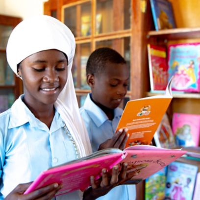
In Pemba, we develop education projects for students and adults and support local growth with courses to raise awareness.
Visit the agri-feedstock projects that contribute to the increasingly sustainable supply of our biorefineries.
The interactive special3D reconstructions, videos and figures: browse our special report and discover the big LNG project off the coast of Mozambique.
find out more